
|
|
700-800 CAPE, SWly flow, convergence, 40 knots of deep layer shear, low LCLs, steep lapse rates rich moisture feed later in afternoon with maximum temps of 20 degrees C in a humid air mass. I had a good feeling about this set up and judging by the model runs high pressure and settled weather would dominate in the near future so this could very well be my last storm chase of Summer. The season has been my personal best to date with prolific thunderstorms, big CAPE days, hot weather, sheared daylight storms, funnel clouds and already three night time storm events under my belt. I have put in a lot of time, energy and miles and felt justified to call the season rite now if I wanted however I simply cannot pass on another storm opportunity so I decided I would focus my last energy into August 25th and give it my best shot, my attitude was that anything else from this day would simply be icing on the convective cake.
This truly felt like a storm day, I've been doing this long enough now to just feel it in the atmosphere, the sensation of the heat and moisture on my skin and the visual sight of the clouds becoming more agitated with the passage of time. The set up looked to favor western parts of Ireland, due to late moisture transportation and a weak capping inversion it seemed that storms would likely fire later in the afternoon along western coastal areas were colder uppers would erode the warm air aloft and allow convection to grow vertically unimpeded. I suspected storms would fire near Mullaghmore and Donegal and perhaps over Fermanagh before moving NE as the trough crossed inland however I was getting skeptical of anything making it to the midlands before solar heating waned however one just never knows with this set up. The N and NW coasts also looked good with CAPE remaining there until late evening so my plan was to play it smart. Instead of racing to the west coast I decided I would hold ground in Maghera and wait to see if storms fired near the Sperrins then moved to the north coast later in the hope of getting a cell in that area and perhaps a lucky few flashes of the sea. The shear profiles were excellent with the convective outlooks going for organized storms with supercell traits, tornado risk, large hail and frequent lightning. I was soon in communication with Dungannon based storm chaser John Fagan and a plan was formed, John was going to meet me in Maghera during the late afternoon and we could chase together.
It was a beautiful day, warm sunshine, blue skies, clam and humid, it felt great to be out in a t-shirt checking the sky every 10 min's while obsessively consulting the radar and sferics in a cycle which never ended as I looked for the first signs of a storm. By mid afternoon I was having doubts, no rainfall anywhere in the country and barely a cloud in sight, Mr Negative was jumping on my shoulder telling me it was game over because the CAP had killed the day, my mood became agitated and frustrated, I wouldn't have been good company, the hours of building excitement and adrenalin then a sudden let down and you are left with an explosive mix of emotions and energy which need to be released in a positive creative manner. I came so close to contacting John and calling off the chase but instead decided that we might as well go for it, our back up plan was that if no storms fired then we could hit the coast for a night shoot so the day wouldn't be in vain.
At 17.00 the CAP broke along the west coast, a few clusters of sferics were showing over Sligo, Fermanagh and Donegal exactly where I had predicted, however they were not enough to have justified the big drive there so I was glad I didn't make that drive. A few refreshes later and there were no more sferics, now I was even more annoyed, maybe that was it for the day, a damp squib, I didn't want to end my great season of storm chasing on a bad note so I tried to stay optimistic. I drove to Glenshane Park n Ride and met John fagan after 18.00 then we stopped on the Pass in Oak Leaf filling station where I managed to get wifi and a look at the charts. There where a few more flashes over W and NW Donegal, that mass of cells looked like it could be visible from the coast so we ended up with a decision to make, stay here incase something fires later or hit the coast?, Glenshane was mostly blue skies with just a few cu around, the air looked completely stable, my instincts told me to move so John and I made a joint decision to head N for the coast, from there we might see those storms from a distance when when the cloud cleared we could do our night shoot. As we drove along the road before Garvagh, John in his van, me in mine, I glanced to the W and noticed several big looking towers far away in the distance, in truth they didn't look all that far away and they looked warm and solid as their charcoal coloured heads bubbled against the warm hazy sky, I began to get a good feeling and suspected we had made the correct decision.
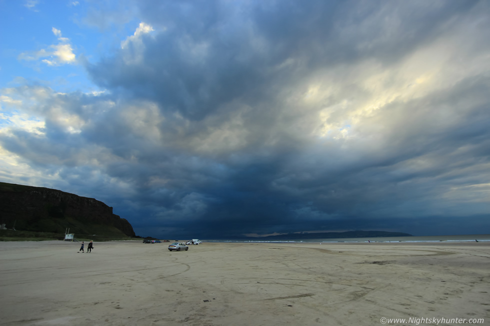 |
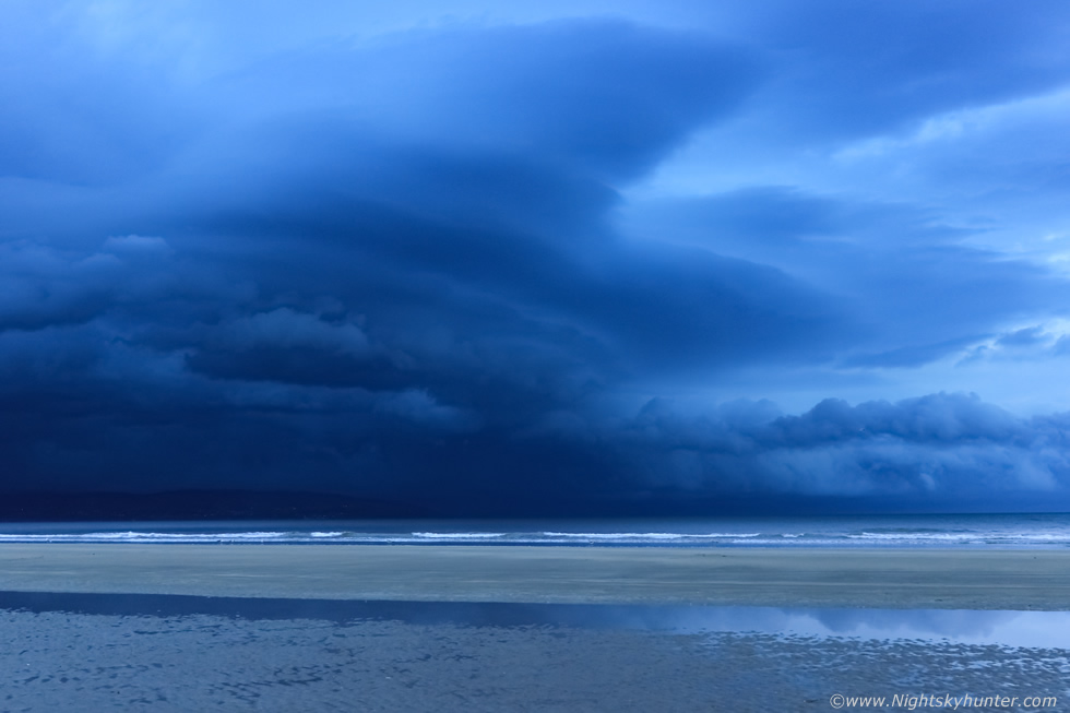
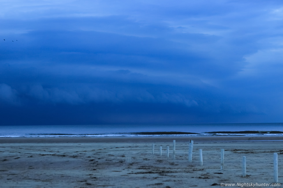
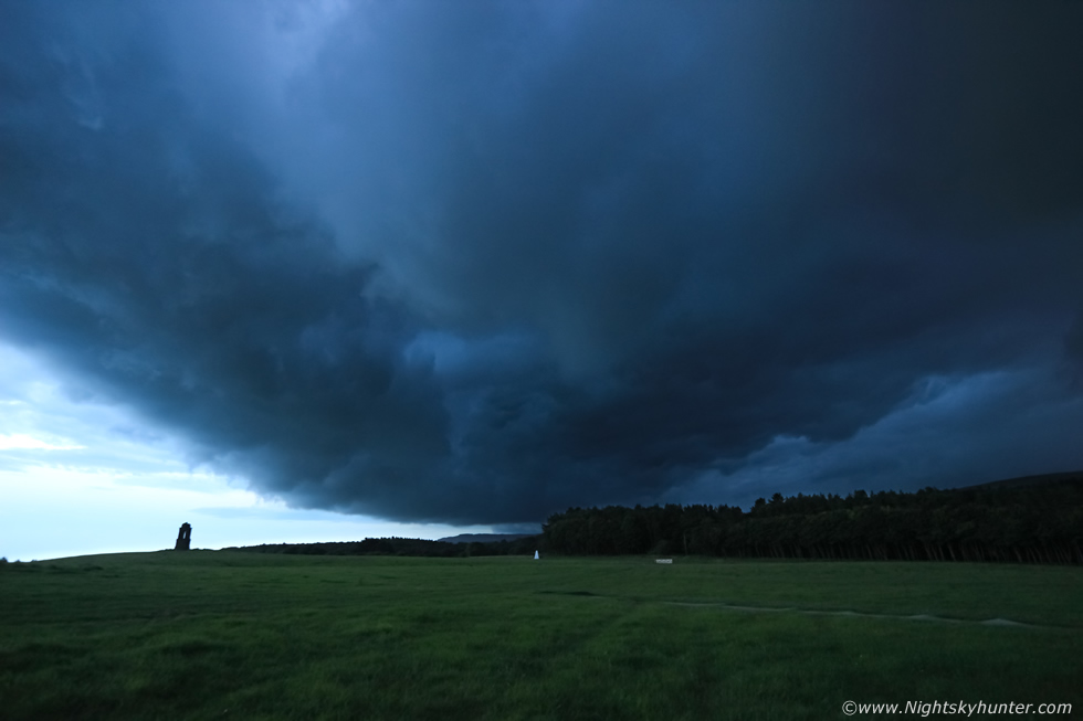
John and I arrived at Downhill Beach, the place was mild and humid with a sense of anticipation. This was the view at 10mm towards the W at Donegal and to the left Magilligan Point. We knew there where storms far beyond this producing random flashes however we had already told ourselves that all would be too distance and we would wait for nightfall for a star shoot. However the longer we stayed he the more curious we became, after a period of observation we both agreed that something was brewing and this chase was far from over, in fact, it might only have begun. It became apparent that a huge line of cloud and convection was crossing the entire skyline from SW to NW, we knew those towers we had spotted on the way up there hidden in that mid level cloud and that that base we could see would be directly below then, we suddenly we afraid to get excited incase we were wrong but we couldn't shake the fact that a storm was growing in front of us. Furthermore those clouds seemed to be getting heavier and darker by the minute and even though the clouds were moving L to R relative to us the entire mass was every so slowly creeping directly towards us, the clouds began taking up more of the sky and the light was dropping as daylight transitioned to an eerie half light. John spotted scud rising from the hills of Donegal which seemed to be getting more lively and sure enough we were convinced that the long dark cloud base was in fact a gust front forming on the outflow air from those big towers behind, this was a new storm growing in front of us and it looked big and mean. At times I thought I heard distant rumbles but I couldn't be sure if it was thunder or the sea, however I knew it had to be thunder.
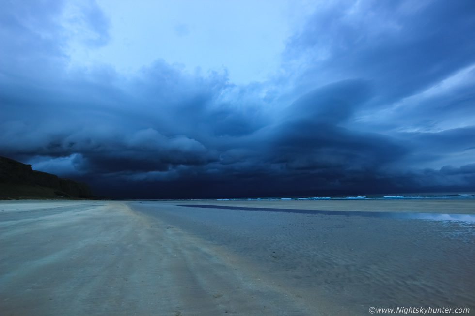 |
Half an hour later the transition was breathtaking, the sky was extremely menacing with low solid clouds building along a horizontal outflow boundary which stretched for miles covering land and ocean simultaneously. I witnessed an absolutely stunning c-g bolt strike down in the darkness to the right of Binevenagh Mountain, it was hands down the most beautiful daylight c-g I have seen this season, a big pink and red bolt striking straight down to Earth with lethal intent sporting numerous red and and branches. WOW I shouted to John, holy c**p, c-g!, that was stunning, it was game on, this storm had now become electrified. John and I gathered up all our gear in a mad rush, camera bag, tripod, ripped the Go Pro from the windscreen, locked the vans and together we ran across the beach closer to the water with a good view directly towards the storm. From here on it seemed like time didn't exist, everything seemed fast yet slow, this was the moment I loved. I had my Go Pro mounted on a mini flexi tripod sitting on the sand taking video for time lapse and my DSLR on tripod while I swapped between four different lenses.
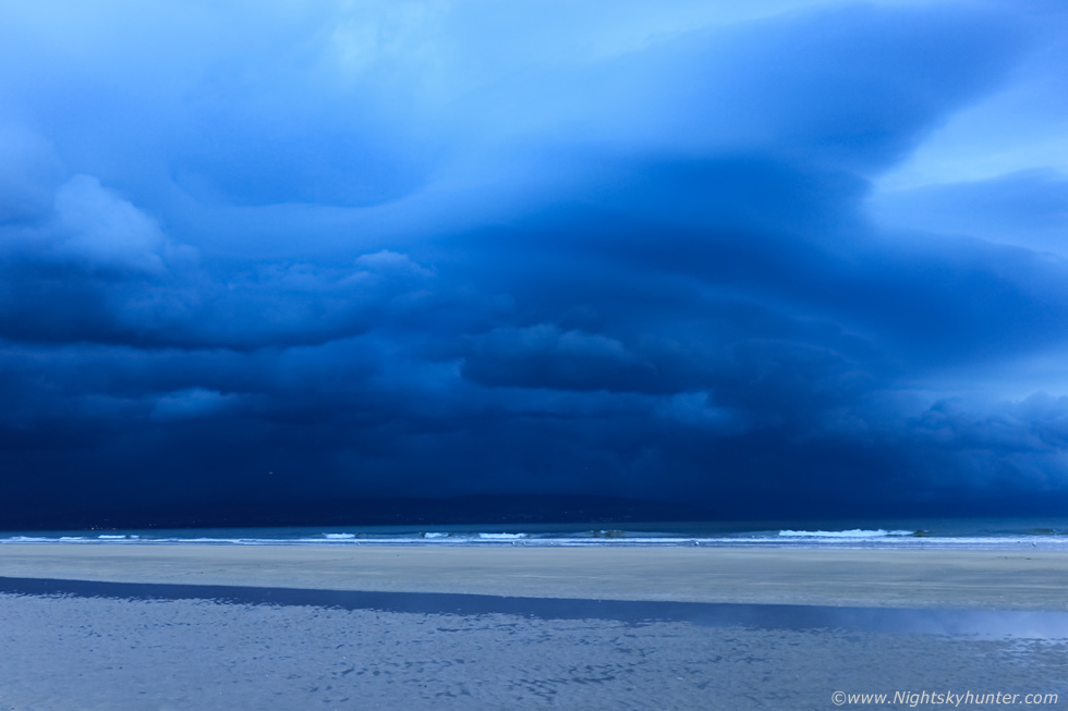 |
Camera turned facing NW towards Donegal, look how eerie the light was, despite it being late in the evening yet still daytime the sky looked like dusk and was darkening by the minute. The storm was moving in slow motion which added to the sense of anticipation, it felt like something big was brewing. I'm shooting with the 50mm F/1.8 here, taking short exposures at ISO 200 then 400 due to the darkness. Pink flashes of lightning would light up the precip under the clouds, first single flashes, then double flashes but my exposures were still too short to capture them, to be honest I was shooting more for the structure.
 |
Then we began getting bouts of four or five flashes in a row expanding across the storm from W to NW, flash, flash, flash, double flash, the scene was spectacular, we couldn't believe our luck. A group of onlookers walked over to us on the beach asking questions about what we were doing, what camera we were using and asking what we were shooting - were they for real? - we pointed out the big thunderstorm dominating the sky then they asked if it was coming this way and we said yes. They asked more questions but it was getting annoying, John and I were concentrating hard, getting settings correct, shooting the storm observing, changing lenses, and my Go Pro kept blowing over as the breeze began to pick up, I don't like being distracted when something is brewing so John and I become unresponsive and soon they got the hint and left us to it...phew...peace at last. Check out the long line of low cloud over the sea to the right, that's almost on the water thanks to low LCLs, at this point Donegal must have been in proper darkness under those clouds.
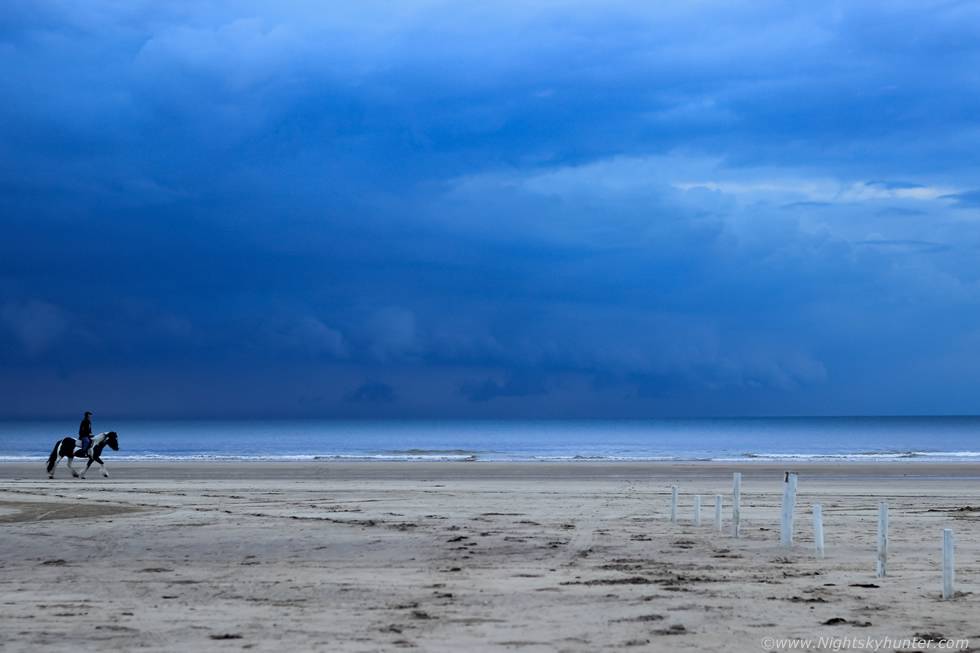 |
Panning camera 90 degrees to the right taking in the full NW sector where out to sea was a massive shelf cloud forming, the sky was hazy thanks to the high dew points so visibility was not the best for sharp contrasty structure. John and I were shooting this scene constantly, image after image, the Horse and rider trotting past the storm clouds really added to the scene. My phone began ringing, I checked ID, it was Conor McDonald, my old storm chasing buddy ringing from Maghera, I answered. Conor immediately asked me where I was, I said the coast, he said man you need to get inland to Maghera fast, massive storm heading that way, I said we couldn't move, we already have a storm here, then we realized this was one massive storm covering the entire western sector of the country, he said lightning rates were awesome, going constantly every second, I said we were getting a good lightning show here so we would remain committed to the northern sector of the storm, Conor informed me the cells where had massive white cores on radar, I could tell from his voice that he was excited, Conor doesn't get excited easily, he has scene amazing storms and supercells in Australia so has a personal high standard, yet I could tell he was worked up, this must be an impressive storm to get this reaction from him, he said he was heading out chasing shortly, so as Conor went after the southern portion of the storm John and I stayed faithful to the north.
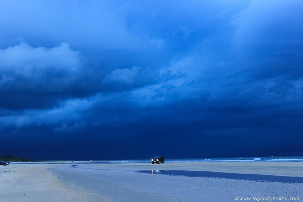 |
Facing back west along the beach, truly menacing skies, black, eerie blue, some of the most heaviest and solid looking clouds I have seen in a long time. John and I were still shooting, pink lightning lit up the darkness at random as the upper forward edge of the clouds began to near us, darkness was creeping in and there was a sense that an unseen monster was about to engulf us all. The SUV looked cool under the dark clouds, lightning strobbed over Magilligan Point and within minutes the SUV left the beach leaving only a couple of cars, people were beginning to seek cover or abandon the beach entirely.
 |
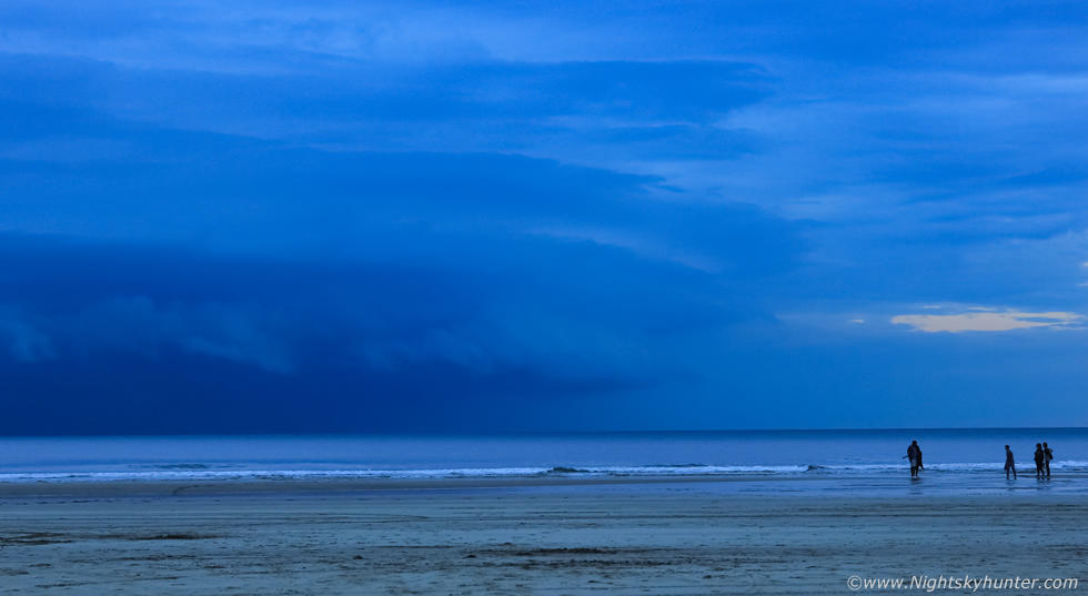
The NW sector was now spectacular, the cool outflow air was scooping warm moist air, lifting it to it's condensation level and forming a shelf cloud. This was the best I had seen since 2009 and John said it was the personal finest he had ever seen. Check out the stacked profile with three layers of laminar cloud, the structure was amazing and the beach walkers added a nice sense of scale. I see the girl was taking images with her phone, I'm sure she has a good one of her boyfriend with that storm in the background.
 |
Lightning flashes and pulsated and the sky rumbled louder each time and a great threatening sensation swept over the beach, John and I were loving it, fists in the air and shouting, this was the stuff we live for. Human activity was dwindling and birds flew for cover as nature took over the show.
 |
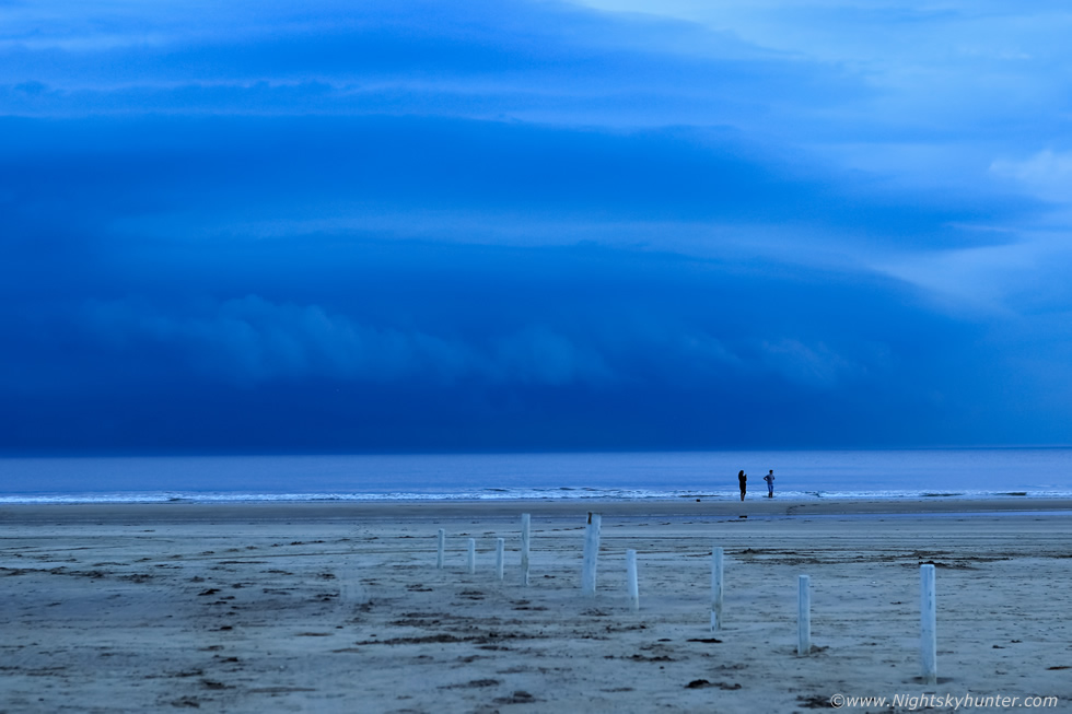
I liked this scene showing the leading edge of the stacked shelf cloud (moving L to R) with the people for a sense of scale, they would soon be running for cover.
 |
Facing west again and last light was being rapidly transformed into night as the core of the monster storm approached, it was almost on us, the outflow winds were picking up fast and sand was getting blown across the beach, this beast was almost on us, this was 10mm wide angle. This has got to be the lowest most threatening storm I have ever seen, as far as cloud height goes, and to experience it over the beach was even more special. My phone rang again, I answered immediately without taking my eyes off the sky, I knew who it was, Conor was shouting down the phone telling me he is chasing along Glenshane Pass and captured an awesome shelf cloud, he said it was like something from Australia, huge, bowing, and with laminated structure like a supercell, I thanked him for the call but said we had our own shelf cloud which was almost on top of us, I didn't have time to talk as we needed to move so we hung up. I could see the clouds swirling in a slow rotating manner over a large area similar to a large vortex in a fluid. We needed to stay ahead of it or else we would loose the structure and be in the rain, John wanted to go on around to Portstewart however I was reluctant to leave what we had but instead would stay local so we ran back tot he vans and drove up the hill and parked at Mussenden Temple which offered a higher view point.
 |
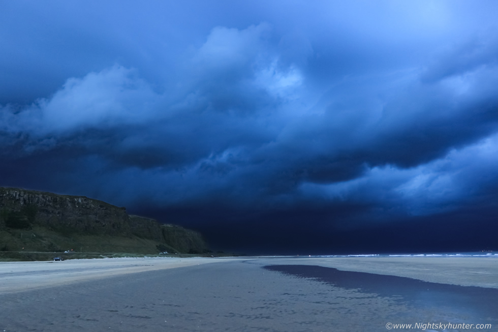
We literally had minutes to get to the top of the hills before the shelf cloud over took us and we would be at the mercy of the rain and lightning with no shelter. John and I ran up the grassy hill carrying camera gear and tripod, this was an experience in itself, I consider myself to be in reasonable shape however this run was nothing short of devastating The combination of adrenaline, the uphill run, gear, excitement, perhaps lack of food and water, whatever, it felt like I was running in slow motion, like one of those nightmares were someone or something was chasing you and you run for dear life only to be frozen in the same spot, I felt heavy and slow, I think my mind was already on top of the hill but my body couldn't move as fast as my mind. My muscles burned and my chest heaved, my breath panting and throat dry and burning, we made it while still trying to catch out breath. We had one minute to ge images before we got blasted, the storm was just moving too quick, I took these couple of shots at 10mm wide angle before the great flood arrived. That's the leading edge of the massive shelf cloud moving R to L and about to swallow up Bishop's Tower.
 |
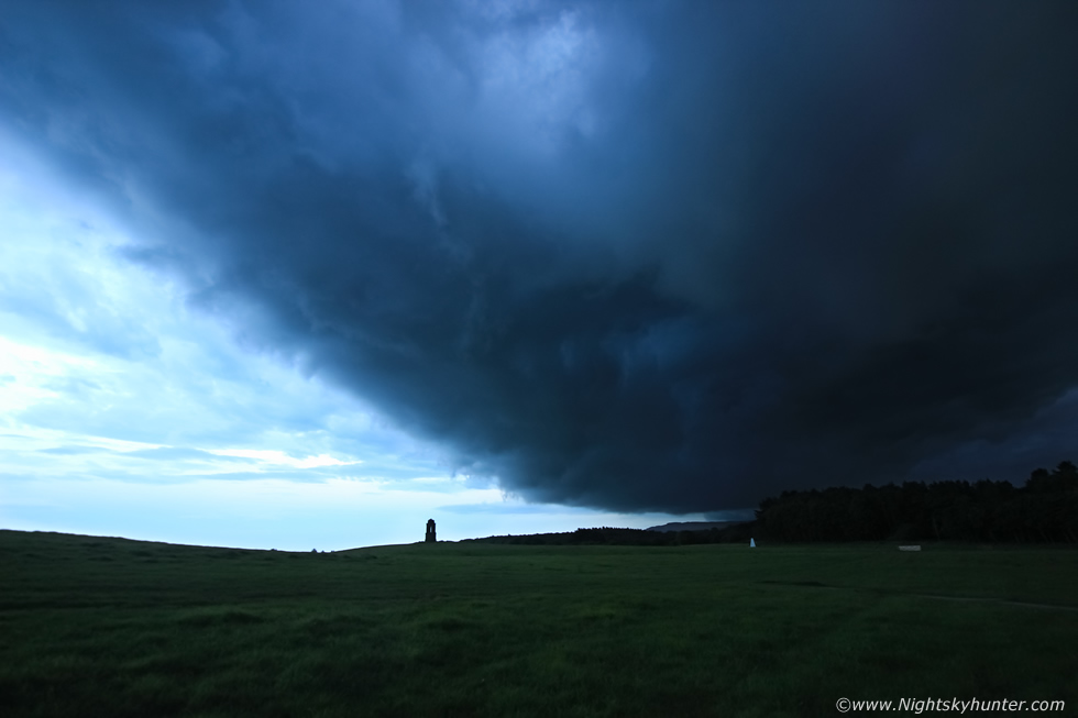
Within less than a minute it was over us with Whales Mouth visible over the trees. This was an ISO800 hand held snap before darkness hit us and rain slammed us out of nowhere with little warning. A big flash of double lightning lit up the rain filled sky in front of John forcing us to duck, we were exposed and in danger so we ran back down the rain soaked hill and to the sanctuary of the vans. John had dropped his van keys in the grass but it was impossible to see in the darkness not to mention the fact we were getting soaked through to the skin so we took cover inside my van and watched the show. Unknown to us at this time, this shelf cloud crossed over the Antrim coast putting on a remarkable display as it surged east, many images appeared on social media the next day which blew out minds, this had been the most spectacular shelf cloud structure ever captured in N. Ireland, had we drove to Portstewart that time we would have captured it however we were not to know this and we were busy up in our own storm adventures while this was going on.
 |
John and I where inside the van, I reversed onto the grass verge and we watched an epic lightning show, we couldn't believe that this was our fourth night time lightning show this season, what a way to end the chase season, on a high like this, nature had been good to us, we yelled with triumph and watched in awe as c-gs and in-cloud bolts whipped and lashed across the sky multiple times illuminating John's van in the process. Some of these scenes would make it onto 'Britains Worst Weather 2016' on Channel 4 which would air during the New Year. The lightning show went on for a long time while torrential rain hammered the glass. After a considerable wait we left the van and went back up the hill when it seemed safe to do so, we had torches and scanned the grass for John's keys. It was a surreal moment with lightning flashing in the sky over Mussenden Temple and ocean while our torch beams swept the grass, it was like a combination of Storm Chasers and The X Files. John found his keys and we were back in business, the storm was still raging but creeping NE over the sea so we raced back down to our original position on Downhill Beach, on this time it was pitch black.
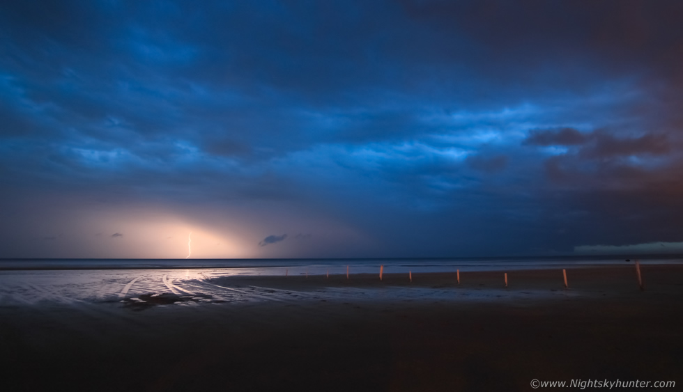 |
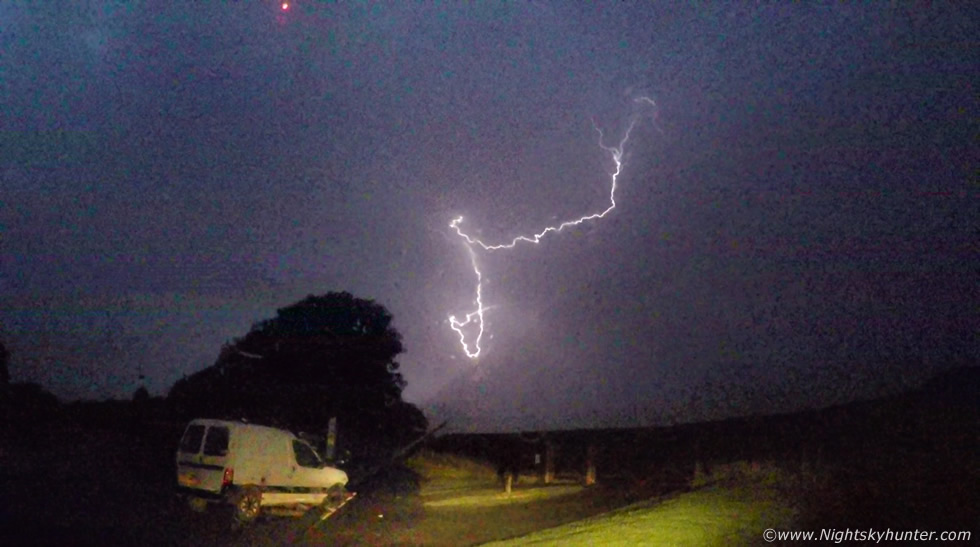
The rain was too heavy to set up the gear outside so I turned the van parallel to the storm and put down the driver's side window half way and using my window clamp I attached my DSLR with 50mm F/1.8 lens to the window edge and began taking exposures. Success, I captured this c-g striking the ocean, I made sure my engine has been turned off to reduce vibrations. Check out the right edge of frame, that's the back of the shelf cloud now surging across the Atlantic towards western Scotland, imagine the view from a ship out to see watching a black sky with lightning illuminating a tremendous shelf cloud then plunging back to darkness, what a sight that would have been.
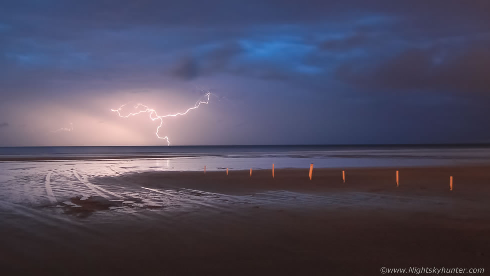 |
I got lucky again, a photogenic c-g did it again, this was my keeper shot of the night and my digital trophy from the hunt. John and I headed into Portstewart and treated ourselves to a well earned take away which we ate in John's mobile home. We were on such a high yet exhausted from all the effort, we waited and waited for the front to clear but there seemed to be a alot of cloud behind the storm, we drove around to Ballintoy, saw a few stars a small breaks in the cloud and even captured a very faint auroral glow before it clouded over once more. At 03.00 we called it a night and we began the drive back home, it would be after 04.00 before I made it back to Maghera. What a storm this was and what a fantastic gift from Mother Nature and the perfect way to end a perfect storm season.
Video footage taken showing various elements of the storm with Go Pro footage of the night lightning at Mussenden Temple car park with slow motion segments. The next day there was a lot of talk about this storm and many images doing the rounds, some called it a supercell however I disagree. This storm did have supercell traits in relation to the wind shear profiles, however the visual structure and radar imagery do not support a supercell with a mesocyclone. This in fact was a well organized multicell thunderstorm cluster which was well sheared and which later took on line convection or squall line qualities when it formed the shelf cloud, however technicalities aside, this storm was a stunner and I was glad John and I had trusted our instincts watched it develop for hours in front of us, you can't ask for better than that, thanks for reading.
Martin McKenna